After several postponed attempts, I finally got up Anthony’s Nose (Eck!). This is the 900 foot rise above the east end of the Bear Mountain Bridge. Here’s what it looks like from the west side of the Hudson, a few hunded yards north of the bridge. It doesn’t look like it’s 900 feet above the Hudson, and when we were up there, it didn’t feel that high, but that’s the height given in Paths Along the Hudson.


There are a few ways to get to the top – straight up from the north side (a bit over a mile walk, but very vertical), or from several locations to the south. We chose to go up from the old Bear Mtn. Bridge toll booth – now a visitor’s center open about three days a week – on the Camp Smith Trail. Total distance is about 4.2 miles.
I went with Maria Abonnel and Regina Riely. Maria used to work for the Park Service and Regina is an experienced hiker, who can bear an uncanny resemblance to Mother Nature. (Uhhh, I’m not really that fat – it’s the shirt!).

Like me, Maria is vertically challenged.

Neither Brigid (doing something with Tim), Joe (rather play on the computer) or Jeanne Marie (headmistress of Montessori school; had to prep for beginning of school year), who’d all gone with me up Breakneck Ridge a couple of weeks ago, were available. Tom Faranda’s Folly: Yesterday’s amble up Breakneck Ridge
This was a really nice walk, a moderate exertion, but not too tough. HOWEVER, around the two mile mark, where another trail joins in, we did lose track of the trail. We scrambled around for about an hour, keeping roughly a nothwesterly direction, before coming back onto the trail. While we were “a might confused” as Daniel Boone once said, we came across some interesting stuff, including a pond or reservoir that we didn’t know existed. It turns out that we had gone a bit further onto Camp Smith property (a big National Guard area; we could hear gunfire from the distant shooting ranges for much of the time) then was part of the plan. But no harm done.
Here’s the pond, which I imagine very few hikers come across.

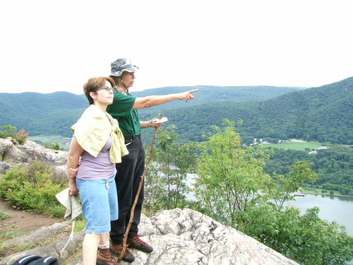
And here are a couple of views on the way to the top


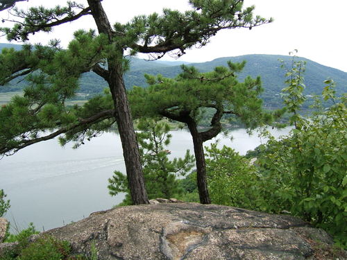
And here’s the view from the top

Maria took this picture of me with the bridge growing out of my head

Maria and Regina had an interest in the fauna on the way up – especially the mushrooms, none of which I can name


And I’m not sure why, but I like these pictures

And here are a couple more of the bridge


I’m hoping that the next trek will be an overnighter on the Appalachian Trail. It will be with Joe and Tim and we are aiming for the Labor Day weekend.
Leave a Reply to Karen Cancel reply