Posted about the first day here. My solo overnighter on the Appalachian Trail, when I was out the Friday and Saturday after Thanksgiving.
The second day was an 8.7 mile hike. Miles five through seven, from Rte 52 going south and west, were unexpectedly tough. Narrow, rocky, up and down, the trail totally covered with leaves. I actually had four falls on this section, each of them a slip on leaves that were covering rocks. It’s a good thing the trail was dry, or I’d have really had troubles. With hindsight, if I’d known the trail was going to be this difficult at this time of year, I would have deferred it until the spring, or done it with other people.
But it did work out. Here are links to the two short videos I took the second day – which give you a sense of how windy it was, and then some pictures.
http://www.youtube.com/watch?v=DjMj2rCDWh4
and here –
http://www.youtube.com/watch?v=gwHRFFH5Cvg
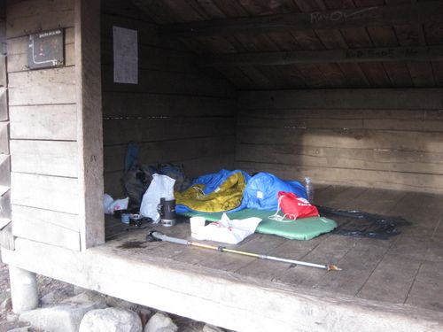
and here, again, is where I slept
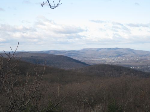
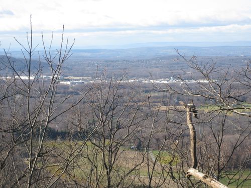
This is the view looking west from the west side of Mt. Egbert, about a half mile from the shelter. This is also where I took the first video, with the link above. The elevation is just over 1,300 feet.
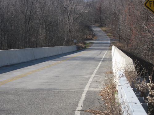
A couple of miles later, and I’ve reached the crossing for Rte 84. Of course it’s a road over the highway.
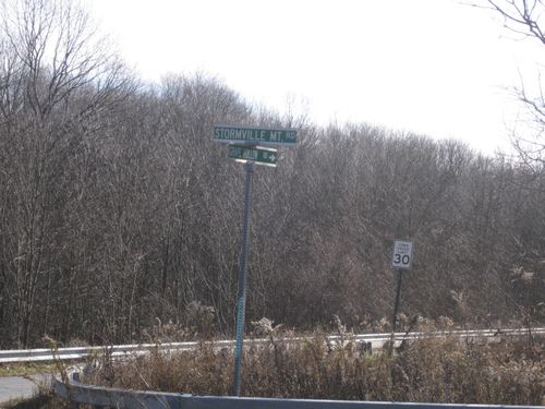
Looking north from the overpass, up Rte 84. If you know the highway, you’ll possibly recognize the rest area, which is a few miles south of where 84 intersects with Rte 684.
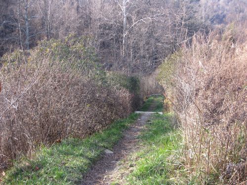
Ok, a pastoral view on the trail between Rte 84 and 52. I just liked it. And it’s right before I crossed Rte 52, and the tricky part of the Trail began. Including my four slips/falls.
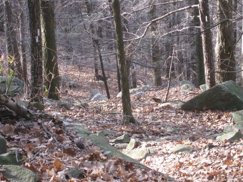
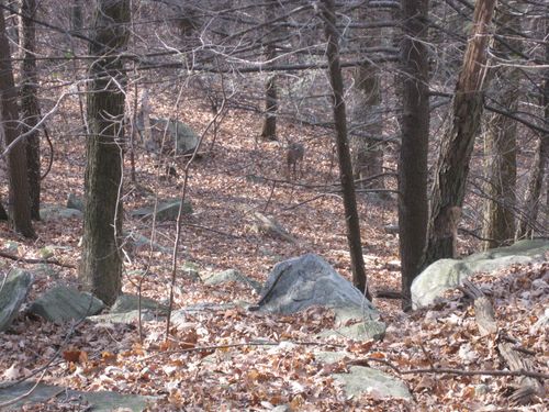
Now west of Rte 52 and two shots of one of the very few animals I saw. In fact, I can’t recall seeing any other animal at all. This deer must know there’s no hunting along the Appalachian Trail! I was on the Trail about forty vertical feet above the deer and probably around 110 feet away. In both pictures the deer is just about smack in the middle.
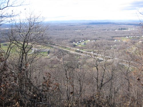
Here’s the intersection of Rte. 84 and the Taconic State Parkway, taken from an elevation of about 1,100 feet, on the western edge of Mt. Hosner. This is near where I took the second video linked above. If you watch the video, you’ll have an idea about the strong wind that day. I’ve driven on these two roads many times, and of course I never thought, “Hey, there’s the Appalachian Trail above me to the east (or south).”
The Trail ahead – close to where I had one of my four slips – and a couple more views looking west. If you travel the Taconic Parkway, you may recognize the farm below.
Just coming off the tough part of the Trail, this fellow was headed the other way. He was going to do some work on the Mt. Hosner Trail, which crosses the A.T.. No doubt a volunteer. We chatted for a couple of minutes, and I confirmed that the Taconic Parkway where the A.T. crossed was only about a mile and a half away. He was the eighth and last person I saw on the Trail that day. They were all day hiking
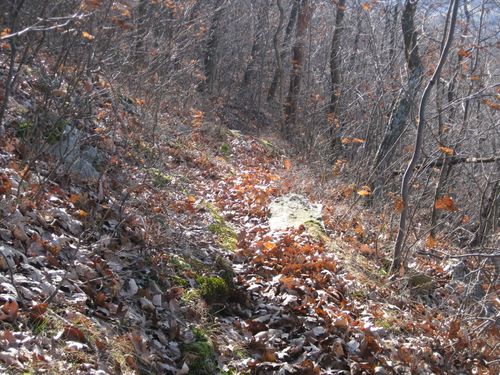
Still tricky.
I took this picture of where I’d just come down. You can see that it’s real easy to slide on the leaves on top of rock.
Coming in for a landing – there’s the Taconic – with the underpass to continue the walk barely visible to the left –
And a view across the Taconic, 80 yards up from where the Miller Hill Road underpass goes under the Taconic Parkway.

Brigid arrived five minutes after I reached the underpass – there’s a Taconic exit and entrance right at Miller Hill Rd. so it was an easy retrieval. I should have taken a picure of her, but I didn’t. instead, here’s a shot of where the A.T. continues on the west side of the underpass. I expect I’ll get on the Trail here, in the spring. Probably as a day hike with a few other people!
Tom-
GREAT photos! But I think you might have been trying to see if we were paying attention. Your reference to the Rte. 84 rest area is, I believe, geographically inaccurate. The rest area pictured is on 84, considerably north and west of the intersection of 684. There is a rest area “a few miles south of where 84 intersects with Rte. 684”, but it is not near the AT and is not as scenic as the one pictured in your beautifully illustrated narrative.
-D
Dennis,
You must be correct. I am going to be looking carefully the next time I head up 84 to Rte 684 to get to CT.
I think I must have not realized just how far north I was when Brigid dropped me on Rte 55 west of Pawling.
Kudos!