Having gone up Sugarloaf mountain the Sunday before, Tom Faranda’s Folly: Tom and Joe’s Sunday climb up Sugarloaf I decided to try another nearby hill / “mountain” in the Lower Hudson Highlands, just north of Cold Spring and south of Sugarloaf. Joe decided he didn’t want to go so I took off on my own.
The hike was much tougher then Sugarloaf. Bull Hill is higher and steeper, and twice I lost track of the marked trail. Rather then the 50 plus minutes it took to get to the top of Sugarloaf, it took 90 minutes to get up Bull. And the total round trip was much longer – 4.5 miles the brochure said. Round trip (it was a circular route) took about three hours and twenty minutes. But I enjoyed it, even though I had a two day backache afterwards.
Here are a couple of views of the old rock quarry you have to circle around on your way to the top of the hill.


And the view looking into the quarry from part way up
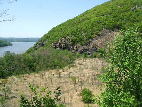
From near the summit, this is the view south, with a telephoto zoom. That’s West Point in the middle

Across to the west is Storm King

And more or less north, between two other hills (one perhaps Sugarloaf Mountain? I’m not sure) you can just see the Newburgh-Beacon bridge

When I got to the summit there was a kid young man sitting there by his lonesome and I asked him how high up we were – I said 8-900 feet and he looked at his typographic map and said “Oh no, more like 12-1300 feet.” So I’m not sure. On the way up I did meet this family group having a picnic, about 75% of the way up. I was puffed, and was amazed to see the little kids! They all seemed cheery.

From the summit you can either re-trace your steps, or take an initially northern path which then swings west and south, to get you to the car park. Over two and a half miles. That’s what I did. It goes down steeply and then you hit the Breakneck Ridge stream, and the trail follows the stream. You then come across some abandoned estate houses like this
l
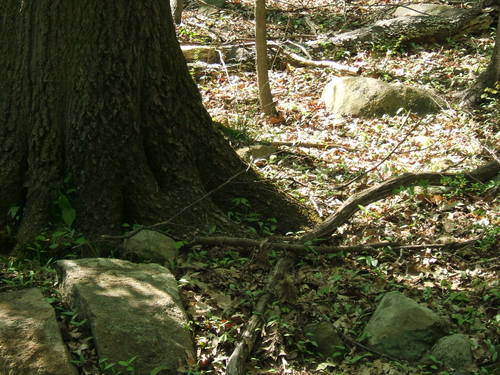
In the next five minutes after taking the above picture I saw two 3 to 4 foot black King snakes – one on each side of the path – if you look REAL CLOSE at the middle of this picture, to the RIGHT of the trunk, you’ll just see the back of the first one
As I moved further down the trail from Bull Hill, there are more and more intersecting marked trails and there were many more people

And within three quarter miles or so of the trailhead, it becomes positively crowded. However very few of these people were going up either Bull Hill or Breakneck Ridge. A walk in the woods was their goal

This past weekend I didn’t get out, but I’m hoping to do something for one day this coming Memorial Weekend. Ideally, I’d like to take a quick ride up to Bash Bish Falls and Mount Everett in the southwest corner of Massachusetts (about a ninety minute ride; near the CT. and NY borders) with joe, but that may not come off.