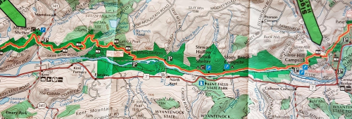
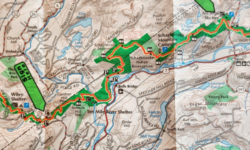
Having prepped for the last five weeks (for example – Second shakedown hike, Beacon to Breakneck), here’s the itinerary and maps for this weekend. I will overnight in the Mt .Algo shelter/lean to. The five or so miles along the Housatonic river are flat. Total distance first day about 11 and a half miles.

Second day from the shelter to the NY State border, again about 11 and a half miles. Tim will pick me up there (hopefully). This is the only section of the 2,100 plus miles of the Appalachian Trail that runs through an Indian Reservation.

To a large extent both sections parallel Rte. 7. Total distance will be about 23 miles and will be seeing other hikers along the way. Not taking any cooking gear – peanut butter, tuna, clif bars etc, and no sleeping bag. Will use a lightweight bivy sack and wear tights. Biggest concern – FALLING!
Will post pictures and perhaps a video. This area will be quite scenic.
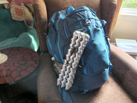
UPDATE: Picture of my pack; base weight is 12 lbs – that’s without food and water. So weight will run 17-18 lbs. (Water is heavy two quarts = 4 lbs). I’m happy with the weight. The funny looking silver thing hanging off the back is a “sit pad” for uhhh sitting on. It unfolds – weighs 2 ounces.

Leave a Reply